
07 3396 9988
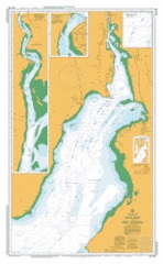
Point Riley to Port Augusta
SKU:
AUS778 Category:
$0.00
Description:
AUS CHART 778 - Point Riley to Port Augusta Name: Point Riley To Port Augusta Scale: 1:150000 Latitude Range: 32 29.01 S - 33 54.51 S Longitude Range: 138 04.65 E - 137 05.28 E Approx Print Size: 1.06m X 0.73m Projection: Mercator
Delivery: approx 3 working days
Additional Info:
The Australian Hydrographic Service currently has over 400 paper charts. All our charts are fully corrected and update to date with the latest Notices to Mariners. The Australian Hydrographic Service was established, and assumed responsibility for hydrographic surveys in Australia, in 1920. In 1946, Cabinet decided that the Royal Australian Navy (RAN) would maintain the national responsibility for hydrographic surveying, nautical charting and the provision of hydrographic services.